How to use the Connecticut interactive trout stocking map
Ever feel like you're playing a perpetual game of hide-and-seek with freshly stocked trout in Connecticut? It's a common frustration to hit a favorite spot only to find it hasn't seen a trout in weeks, or worse, you just missed a major stocking. Luckily, the Connecticut Department of Energy and Environmental Protection (DEEP) offers an incredibly helpful tool: the Connecticut interactive trout stocking map. This guide will walk you through exactly how to master this resource, so you can spend less time guessing and more time reeling in those beautiful fish.
The Frustration of Finding Freshly Stocked Trout
Let's be honest, we've all been there. You wake up early, excited for a day of trout fishing, only to arrive at your go-to river or pond and find it’s completely dead. Maybe you see a few older fish, but certainly none of the eager, recently stocked beauties you were hoping for. The feeling of wasted time and gas, coupled with the disappointment of a slow fishing day, can be incredibly discouraging. It often feels like you need an insider tip or a secret network to know when and where the trout are being released.
This challenge is especially true in Connecticut, where a vast network of rivers, streams, lakes, and ponds are stocked annually. The sheer volume of waterbodies and the unpredictable timing of stockings make it nearly impossible to consistently hit the sweet spot without some serious help. Anglers often rely on old fishing reports, social media rumors, or just plain luck, which, more often than not, leads to frustration rather than a full creel. The game of finding trout doesn't have to be this hard, especially when the solution is readily available.
Why Knowing Stocking Details Matters
Knowing exactly when and where trout have been stocked isn't just about catching more fish; it's about making the most of your valuable time on the water. Freshly stocked trout are often more active and less wary, having not yet fully adjusted to their new environment or developed a strong fear of anglers. This can translate to more bites, more action, and a much more enjoyable experience, especially for beginners or those bringing kids along. Imagine the joy of seeing a young angler catch fish after fish, rather than casting endlessly with no reward.
Beyond the immediate success, understanding stocking patterns helps you develop a strategic approach to your fishing season. You can plan your trips around recent stockings, ensuring you're targeting waters with a high density of fish. This knowledge allows you to explore new areas confidently, knowing they've been recently replenished, rather than sticking to the same few spots out of habit or uncertainty. It transforms your fishing from a hit-or-miss affair into a much more targeted and rewarding endeavor.
Moving Beyond Guesswork and Rumors
For years, many anglers relied on word-of-mouth, local bait shops, or generalized stocking schedules printed in the annual fishing guide. While the Reading the Connecticut Fishing Guide is an invaluable resource, it doesn't offer real-time updates. You'd hear whispers about a certain pond getting "a fresh load" or a river being "just hit," but by the time you got there, the crowds might have thinned out the fish, or the report itself could have been outdated. This kind of anecdotal information, while charming in its own way, is rarely accurate enough to consistently put you on fish.
The Connecticut interactive trout stocking map eliminates this guesswork entirely. It provides official, up-to-the-minute data directly from the CT DEEP, detailing exactly which waters have been stocked, with what species, and how recently. This means you no longer have to wonder if a report is true or if you're a day late and a dollar short. You get reliable, factual information at your fingertips, allowing you to plan your trips with confidence and precision. It’s like having a direct line to the stocking trucks, without actually needing to chase them down!
A Step-by-Step Guide to the Connecticut Interactive Trout Stocking Map
The Connecticut interactive trout stocking map is an incredibly powerful resource, but like any new tool, it can seem a little daunting at first glance. Don't worry, it's actually quite intuitive once you know what you're looking for. The map is updated frequently, sometimes daily, especially during the peak stocking seasons in spring and fall, ensuring you have the freshest information available.
To start, you'll want to navigate to the official Connecticut DEEP website. A quick search for "CT DEEP trout stocking map" will usually get you there directly. Once on the map page, you'll see a dynamic map interface, typically centered on Connecticut, dotted with various icons and offering a range of filtering options. Don't be afraid to click around and explore; you can't break anything! The interface is designed to be user-friendly, whether you're viewing it on a desktop computer or a mobile device while on the go.
Accessing the Map and Understanding the Layout
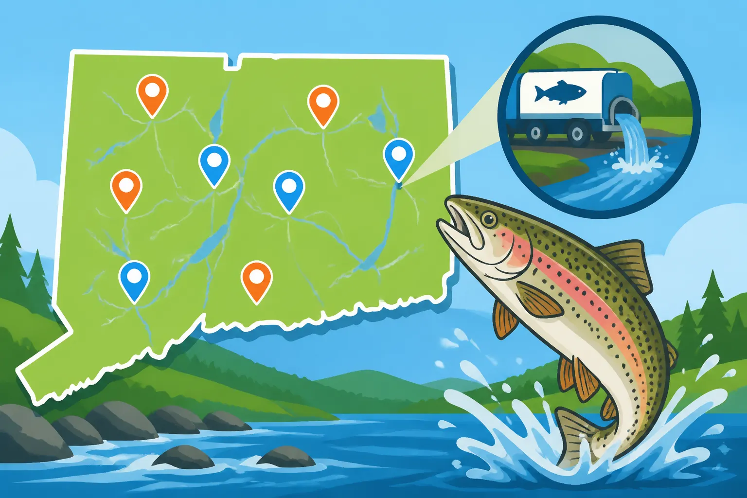
When you first open the map, you'll notice a few key components. The main area is, of course, the map itself, showing the geographic layout of Connecticut's waterbodies. To one side, or perhaps at the top, you'll find a legend explaining what the different symbols or colors on the map mean. There will also be controls for zooming in and out, panning across the state, and often a search bar where you can type in a specific town or waterbody name.
The initial view might be a bit overwhelming with many points of interest. That’s where the filtering options come into play, which we’ll dive into next. Think of the map as a sophisticated, constantly updated weather forecast for trout. Just as you check the forecast to know if you need rain gear (which you can find great options for on Amazon), you'll check this map to know if your preferred fishing spot is primed for action. The map’s design is usually quite responsive, though like any online mapping tool, a strong internet connection helps it load smoothly and quickly, especially on a mobile device where data speeds can vary.
Navigating and Filtering for Your Perfect Spot
The real magic of the interactive map lies in its ability to filter data. Instead of sifting through every single stocking event in the state, you can narrow down your search to precisely what you're looking for. Most maps will offer filters for:
- Date Range: This is perhaps the most critical filter. You can typically select to view stockings from the last 24 hours, last 3 days, last week, last month, or even a custom date range. For the freshest fishing, focusing on the last 24-72 hours is usually your best bet.
- Species: Looking specifically for brown trout, rainbow trout, or brook trout? You can often select one or more species to highlight only those stocking events. This is especially useful if you have a preference or a specific technique in mind, like Fly Fishing for Trout in Connecticut which might target certain species.
- Waterbody Type: Want to fish a river, a lake, or a small pond? The map usually allows you to filter by these categories, helping you hone in on the type of waterbody that suits your fishing style.
- County: If you're planning a trip to a specific region, filtering by county can quickly show you all the stocked waters in that area. This is great for exploring new territory without having to manually scan the entire state.
Let’s say you’re looking for a good spot to catch some rainbows in Tolland County that were stocked this week. You’d simply select "Rainbow Trout" under species, "Tolland" under county, and "Last 7 Days" under date range. The map will then refresh, showing you only the relevant stocking locations. Clicking on any of the remaining points on the map will typically bring up a small pop-up window with even more specific details about that particular stocking event, including the exact date, the quantity of fish, and the specific section of the waterbody stocked.
Decoding the Details: What the Map Tells You
Once you've navigated and filtered the map to your liking, the next step is to understand the information it presents. Each colored dot or icon on the map represents a stocking event, and clicking on it reveals a treasure trove of data. This isn't just a list; it's a dynamic report that empowers you to make informed decisions about your fishing adventure. Don’t just look at where the dots are; dig into what each dot means.
The legend on the map is your first key to understanding. It will typically explain the significance of different colors or symbols. For example, a bright green dot might indicate a stocking within the last 24 hours, while a yellow dot could mean a stocking within the last week, and a red dot for a longer period. This color-coding instantly tells you how "fresh" the stocking is, which is often the most critical factor for immediate fishing success. Remember, freshly stocked areas usually mean more active fish and less fishing pressure over time.
Understanding the Icons and Color Coding
The symbols and colors used on the Connecticut interactive trout stocking map are designed to convey information quickly and efficiently. While the exact scheme might vary slightly over time, here's a general idea of what you might encounter:
| Map Feature | Common Interpretation | Why it Matters for Anglers |
|---|---|---|
| Bright Green Dot | Stocked in the last 1-2 days | Highest probability of active, eager fish. Go NOW! |
| Yellow/Orange Dot | Stocked in the last 3-7 days | Still good fishing, but fish may be spreading out or becoming warier. |
| Red/Blue Dot | Stocked beyond 7 days | Fish will be more dispersed, harder to target, but still present. |
| Fish Icon (generic) | General trout stocking location | Provides specific details upon clicking. |
| Specific Fish Icon | Stocking of a particular species (e.g., a specific trout silhouette) | Helps target brown, rainbow, or brook trout specifically. |
| River/Stream Line | Stocking in a river or stream segment | Indicates a linear fishing opportunity; often requires wading or bank access. |
| Pond/Lake Shape | Stocking in a lake or pond | Indicates a larger, more contained waterbody, potentially suitable for boat or shore fishing. |
When you click on one of these icons, a small information box will pop up. This box is crucial! It will usually display the exact date of the stocking, the specific species of trout released (e.g., "Rainbow Trout"), and the quantity (e.g., "500 fish"). Sometimes, it might even provide notes on the specific access point or section of the waterbody. This level of detail allows you to make an informed decision about where to go and what to expect. Knowing the quantity, for instance, can give you an idea of potential fishing pressure. A location stocked with thousands of fish might attract a larger crowd initially, but also offers more targets.
Interpreting Stocking Dates and Quantities
The stocking date is arguably the most important piece of information. Trout that have just been released are often disoriented and actively feeding, making them easier targets. Generally, the closer the stocking date to your planned fishing trip, the better your chances of success. Many anglers try to time their trips within a day or two of a stocking event. If you see a spot was stocked yesterday, that’s your golden ticket! Keep in mind that heavy rain can sometimes impact stocking schedules, so it's always good to check the map again before heading out, even if you planned a day or two in advance.
The quantity of fish stocked also provides valuable insight. A small pond might receive a few hundred trout, while a large river could see thousands. Larger quantities often mean more spread-out fish, but also potentially more competition from other anglers. Smaller, more localized stockings can be fantastic if you get there early, as the fish are concentrated. Pay attention to both of these details as you plan. For instance, a stocking of "500 Brown Trout" in a small, accessible pond like Hopeville Pond will fish very differently from "2,000 Rainbow Trout" spread across several miles of the Best Trout Streams in Connecticut such as the Farmington River.
Beyond the Numbers: Considering Waterbody Characteristics
While the map tells you where and when the fish were stocked, it doesn't always tell you what the fishing will be like. This is where your personal angling knowledge, combined with other resources, comes into play. For instance, a long stretch of river might be stocked, but is it easily accessible? Does it have deep pools, riffles, or pocket water? What are the typical water levels like, and is it a good spot for Spring Trout Fishing Techniques for Connecticut Streams?
Consider the specific characteristics of the waterbody. Is it a wide, open lake like Candlewood Lake, or a narrow, heavily wooded stream? This will influence the gear you choose and the techniques you employ. For example, a recently stocked trout pond with easy access might be perfect for bait fishing with simple spinning gear, whereas a river known for its brown trout might call for more sophisticated fly-fishing techniques. The map gives you the "what" and "where," but you'll still need to bring your expertise to figure out the "how." Don’t forget to make sure you have a valid Connecticut Fishing License Guide for 2026 and the correct Connecticut Trout and Salmon Stamp, Explained if required, before hitting the water!
Maximizing Your Trout Fishing Success with the Map
Having the Connecticut interactive trout stocking map at your disposal is like having a secret weapon. It provides a distinct advantage, but merely knowing about it isn't enough. To truly maximize your success, you need to integrate the map's information into a comprehensive fishing strategy that combines real-time data with local knowledge, careful planning, and ethical angling practices. Think of it as the ultimate scout report before the big game.
The map is a living document, constantly updated by the CT DEEP. This means the information is fresh, but it also means you need to check it frequently. A quick glance the night before, and again the morning of your trip, can save you a lot of disappointment. If you’re targeting a specific species, like the feisty rainbows, you’ll want to utilize the species filter. Maybe you’ll even find a less-pressured spot that’s a bit off the beaten path, away from the crowds that tend to flock to the most popular stocking points.
Planning Your Trip: Timing and Logistics
The first step after identifying a promising stocking event on the map is to plan your logistics. Timing is paramount. If you see a major stocking at your target location, aim to be there as early as possible on the day of or the day after the stocking. These fish are often eager to bite, and the early bird truly gets the worm (or the trout, in this case!). But also consider what time of day you'll be fishing. Early mornings or late afternoons often provide the best conditions, regardless of stocking, as the fish are generally more active.
Think about how you'll get to the waterbody and what access points are available. The map might show the general location, but a quick cross-reference with a satellite map can reveal parking areas, trails, or public access points. Also, consider the potential for crowds. If a popular spot like the Farmington River is stocked heavily, expect company. Sometimes, looking for smaller, less-known ponds or stream sections that have also received a recent stocking can lead to a more peaceful and equally productive outing. Remember to always double-check Connecticut Fishing Regulations Explained and especially the Connecticut Trout Limit and Possession Rules for the specific waterbody you plan to fish, as rules can vary.
Combining Map Data with Local Knowledge and Conditions
The interactive map is an incredible tool, but it's not a substitute for local knowledge and understanding current conditions. Think of it as the core intelligence, which you then enhance with additional information. Before you head out, consult other resources. What’s the weather forecast? Has there been heavy rain, which could muddy up a stream or raise water levels? How clear is the water currently? These factors significantly impact how trout behave and what techniques will be most effective.
Engage with local bait shops; they often have a pulse on what's biting and what conditions are like in real-time. Online fishing forums or local fishing groups can also provide recent observations that complement the map data. While you're preparing your gear, consider bringing a variety of lures and baits, which you can easily stock up on from a reputable online retailer like Amazon. Having options like powerbait, worms, small spinners, or even a fly box with various patterns ensures you're ready for whatever the trout are keying in on. A good quality pair of polarized sunglasses, also readily available on Amazon, will help you spot those subtle takes and even cruising fish once you're on the water.
Ethical Angling and Conservation
With great power comes great responsibility, and using the stocking map is no exception. While the goal is to catch fish, it’s also crucial to practice ethical angling and conservation. Stocked trout are a resource for everyone, and responsible behavior ensures the fishery remains healthy and enjoyable for years to come.
This includes respecting property boundaries, properly disposing of your trash, and being mindful of other anglers. If you're practicing catch and release, especially with older, larger trout, handle them gently with wet hands and release them quickly to ensure their survival. Consider using barbless hooks, which can reduce harm to the fish. Ensure you've purchased your required license, understanding How Much Does a Connecticut Fishing License Cost, as revenue from license sales directly funds these vital stocking programs. A reliable fishing net, also purchasable on Amazon, can make landing and releasing fish much safer and easier for both you and the fish. By combining the power of the Connecticut interactive trout stocking map with responsible angling, you're not just improving your own success, but contributing to the health and future of Connecticut's fantastic trout fishery.
Disclaimer
The information provided in this guide is for general informational purposes only and is subject to change. Always consult the official Connecticut Department of Energy and Environmental Protection (CT DEEP) website and their most current regulations and maps for the most accurate and up-to-date information before engaging in any fishing activities. Fishing regulations, stocking schedules, and map features can be updated frequently.