How to read structure for striped bass in Long Island Sound
The thrill of chasing striped bass in Long Island Sound is undeniable, but it can quickly turn into frustration when you're just blindly casting into open water, wondering why the fish aren't biting. Many anglers struggle to consistently find these powerful game fish because they haven't learned the art of "reading" the underwater world. This comprehensive guide is here to unravel the mysteries of structure fishing, teaching you how to identify prime striped bass habitat and transform your fishing success on the Sound.
Understanding Striped Bass Behavior Around Structure
Striped bass aren't just swimming around aimlessly; they are incredibly efficient predators and masters of using their environment to their advantage. When you understand why they relate to certain underwater features, you're already halfway to finding them.
Why Structure Attracts Stripers
Think of structure as real estate for fish. It provides everything a striped bass needs to survive and thrive, especially in a dynamic environment like Long Island Sound.
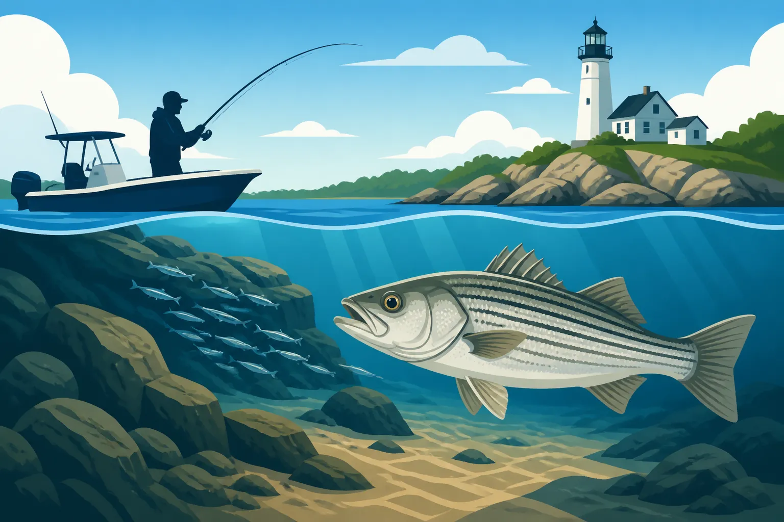
- Baitfish Accumulation: This is perhaps the biggest draw. Structure often creates current breaks or eddies, which in turn trap and concentrate baitfish like bunker, spearing, sand eels, and even squid. Stripers know this, and they'll stage themselves nearby, waiting for an easy meal to come by. A rocky reef, for example, might hold a school of silversides seeking refuge from stronger currents, making it a prime feeding ground for a hungry striper. You'll often see these baitfish schools on your sonar, a clear indicator that stripers might be lurking below.
- Ambush Points: Striped bass are ambush predators. They love to hide in slack water or behind an obstruction, letting the current bring unsuspecting prey directly to them. A sharp drop-off, a submerged rock pile, or the edge of a channel all provide perfect ambush points. They can sit just out of the main current, conserving energy, and dart out when a meal presents itself. This is particularly true during strong tidal flows when baitfish are being swept along.
- Current Breaks and Eddies: The ever-present currents of Long Island Sound can be exhausting for fish to constantly fight. Structure, whether natural or man-made, disrupts these currents, creating zones of calmer water where stripers can rest and hold. These eddies are also where disoriented baitfish often get swirled around, making them easy targets. Learning to identify these subtle current changes on the surface can be a dead giveaway for hidden structure below.
- Shelter and Safety: While often overlooked, structure also offers protection. It provides shelter from strong tides, stormy weather, and even from larger predators if a smaller striper feels threatened. In deeper areas, ledges and humps can offer a sense of security, especially during bright sunny days when stripers prefer to stay out of direct sunlight.
Key Types of Structure in Long Island Sound
Long Island Sound is a geological tapestry of various underwater features, each holding its own appeal for striped bass. Knowing what these structures are and how they look on your charts and sonar is crucial.
- Reefs and Rocky Bottoms: These are natural formations, often remnants of glacial activity, characterized by jagged rocks, boulders, and uneven bottom contours. They are classic striper haunts, providing excellent cover, numerous ambush points, and prime areas for shellfish and crabs, which also attract baitfish. The larger the rocks, the more intricate the network of hiding spots. Places like the reefs off Niantic or around the Thimble Islands are notorious for holding stripers.
- Wrecks and Artificial Reefs: From sunken ships to deliberately deployed concrete and rock piles, wrecks are artificial structures that become ecological hotbeds. They quickly attract barnacles, mussels, and other marine life, which in turn draw baitfish, and ultimately, striped bass. These can be incredibly productive, but they also demand careful fishing to avoid snagging your gear.
- Drop-offs and Ledges: These are sudden changes in depth, where the bottom contour drops sharply from a shallower flat to deeper water. Stripers use the edge of these drop-offs as a "highway," patrolling them for baitfish moving between depths. Ledges often have overhangs and crevices that provide excellent cover. They are particularly effective when baitfish are pushed up against them by current or predators.
- Humps and Bumps: These are elevated areas on an otherwise flat bottom, essentially underwater hills. They act like magnets for baitfish, which congregate around them, and in turn, draw stripers looking for feeding opportunities. A hump might only rise a few feet off the bottom, but that small change in elevation can be enough to concentrate fish.
- Channels and Edges: Long Island Sound is crisscrossed with natural and dredged channels that serve as major thoroughfares for migrating fish and bait. The edges of these channels, where the depth changes from shallow to deep, are critical striper spots. Current often accelerates along channel edges, creating feeding lanes.
- Mussel Beds and Oyster Reefs: These living structures might not look as dramatic as a sunken wreck, but they are vital ecosystems. The mollusks themselves are a food source, and the rough, uneven bottom they create provides shelter for smaller crabs and baitfish, making them attractive to stripers, particularly during periods of lower light or slack tide.
Tools and Techniques for Identifying Structure
You don't need to be a marine biologist to read the Sound, but a combination of modern electronics, traditional navigation tools, and keen observation skills will significantly improve your chances.
Using Marine Electronics Effectively
Modern boat electronics have revolutionized how we find fish, but they're only as good as your ability to interpret what they're telling you.
- Sonar (2D, SideScan, DownScan): This is your underwater eye.
- 2D Sonar (Traditional Sonar): This classic view shows you what's directly beneath your boat. You'll see the bottom contour, often represented by a strong, thick line. Any irregularities, like jagged peaks (rock piles) or sudden drops, will be evident. Fish arches will appear above the bottom. Pay close attention to the hardness of the bottom; a thick, dark bottom return usually indicates hard structure like rocks, while a thinner, lighter return might be soft mud or sand. Many anglers find reliable 2D sonar units like those from Lowrance and Garmin to be indispensable, and you can find a wide range of these devices, often with great deals, on platforms like Amazon.
- DownScan Imaging: This provides a photo-like image of what's directly beneath your boat. Structure appears much clearer, allowing you to distinguish individual boulders, tree limbs on a wreck, or distinct changes in bottom composition. You can often see baitfish schools tightly packed around a piece of structure, and even the stripers themselves hugging the bottom or suspended nearby.
- SideScan Imaging: This is a game-changer for finding structure off to the sides of your boat, scanning up to hundreds of feet on either side. It allows you to cover a vast area quickly, identifying submerged rock fields, isolated wrecks, or the edges of channels that you might otherwise drive right over. Structure will cast a "shadow" on the screen, indicating its height off the bottom. If you're looking for new grounds, SideScan can pinpoint unknown areas. Many higher-end Garmin and Humminbird units offer excellent SideScan capabilities.
- GPS and Chartplotters: Your GPS is crucial for navigation and for marking spots once you find them.
- Marking Waypoints: When you find a piece of promising structure or observe fish on your sonar, mark it immediately with a waypoint. This allows you to return to it precisely, even in different conditions.
- Understanding Contours: Your chartplotter will display nautical charts with depth contours. These lines connect points of equal depth. Closely spaced contour lines indicate a steep drop-off or ledge, while widely spaced lines suggest a gradual slope. Look for areas where contours pinch together or form intricate patterns, indicating potential structure like humps, channels, or rocky areas. Cross-referencing your GPS position with these contours is vital for understanding the underwater terrain. Don't forget to regularly update your chart cards or electronic maps, as new data can reveal previously unknown features.
Interpreting Nautical Charts and Topographical Maps
Long before fancy electronics, anglers used charts, and they remain a foundational tool for any serious fisherman.
- Reading Depth Contours: As mentioned, these lines are your best friend. A contour interval might be 6 feet or 10 feet. The tighter the lines, the steeper the incline or decline. Imagine these lines as elevations on a mountain map, but underwater. Seek out areas where these lines create interesting patterns: fingers of shallow water extending into deep, sudden changes in depth, or tight clusters that hint at significant underwater relief.
- Symbols for Structure: Nautical charts use specific symbols to denote underwater features.
- Rocks (Rk): Scattered rocks, rock ledges, or rock formations.
- Wrecks (Wk, PA, ED): These indicate charted wrecks. "Wk" means visible wreck, "PA" means "position approximate," and "ED" means "existence doubtful." Always exercise caution around wrecks as they can be navigation hazards.
- Obstructions (Obstn): General term for underwater hazards, which can include anything from sunken debris to artificial reefs.
- Foul Ground (Foul): Areas with numerous obstructions, often rocky or with debris, making navigation or anchoring difficult. These are often excellent fishing spots.
- Bottom Type Abbreviations: Abbreviations like "S" (sand), "M" (mud), "R" (rock), "Sh" (shell), "G" (gravel) provide clues about the bottom composition, which can also influence fish behavior. Rocky bottoms are almost always better for striped bass than vast expanses of soft mud.
- Cross-referencing with Real-time Observation: Charts give you a great overview, but combine them with what you see on the water. A chart might show a rocky area, but your sonar will reveal the exact depth and density of those rocks. A marked channel on a chart will correspond to the actual current flow and the way the surface water is moving. The beauty is in using both in concert.
Reading the Water Without Electronics
Even without the most advanced electronics, keen observation skills can help you identify potential striper holding areas.
- Current Seams and Rips: Look for lines or changes in the water's surface where two different currents meet or where current is moving rapidly over an obstruction. These are often visible as distinct color changes, lines of foam, or agitated water. These "rips" and current seams are classic ambush points for stripers, as baitfish get disoriented and swept along them. Fishing along these seams, letting your lure drift with the current, can be incredibly effective.
- Eddies: These are areas of calmer, swirling water, often found just downstream or on the leeward side of a significant obstruction (like a prominent point, jetty, or large submerged rock). Baitfish will congregate in these calmer waters, and stripers will sit on the edge, darting into the main current to feed.
- Bird Activity: Gulls, terns, and gannets diving or congregating intensely are almost always a sign of baitfish being driven to the surface from below. While this often points to actively feeding stripers, it can also indicate the presence of structure that's holding those baitfish. If you see birds working over a specific area consistently, there's likely a reason, and that reason is often structure or bait related.
- Baitfish Flicking and Surface Boils: Seeing baitfish jump or "flick" on the surface is a clear sign they are being harassed. If you see larger splashes or violent disruptions—"boils"—it's almost certainly stripers actively feeding. These surface disturbances often occur over or near structure, as stripers use the underwater features to trap their prey. When you encounter active surface feeding, especially when you are looking for Best Time of Day to Catch Striped Bass, you know you're in the right place.
Fishing Strategies for Common Long Island Sound Structures
Once you've located the structure, the next step is to present your bait or lure in a way that entices a striped bass. Different structures demand different approaches.
Tactics for Reefs and Rocky Outcrops
Reefs and rocky areas are high-probability spots, but they also come with a high risk of losing tackle.
- Understanding Tides and Current Flow: Stripers will position themselves differently depending on the tide. On an incoming or outgoing tide, they'll often sit on the current-breaking side of the reef, waiting for bait to be swept over. During slack tide, they might spread out over the top of the reef, foraging more actively. Studying the Connecticut Fishing Seasons by Month can give you an idea of peak striper activity.
- Jigging and Drifting Live Bait:
- Jigging: Vertical jigging with heavy diamond jigs or soft plastics is very effective over reefs. Drop your jig to the bottom, reel up a few feet, and impart a vigorous jigging motion. This mimics a wounded baitfish. Be ready for a strike on the fall! Look for metal jigs in various weights on Amazon to match the current and depth.
- Drifting Live Bait: Drifting live bunker, eels, or even legal-sized porgies (scup) over a reef system is incredibly productive. Use a three-way swivel with a sinker heavy enough to keep your bait near the bottom but allow it to tumble naturally with the current. This presents a very natural offering that stripers find hard to resist.
- Casting Soft Plastics and Plugs: If the current allows, casting soft plastic paddle tails or bucktail jigs and retrieving them over the reef, or even casting topwater plugs at dawn or dusk, can be exhilarating. The key is to get your lure into the strike zone without constantly snagging.
- Safety Considerations (Snags): Always be mindful of snags. Use heavier leader material to resist abrasion, and be prepared to break off if you get hopelessly stuck. Sometimes, using a float or a balloon to suspend your bait just above the snaggiest part of the reef can be a smart move.
Fishing Wrecks and Artificial Reefs
Wrecks are often deep-water structures, requiring different techniques.
- Vertical Jigging: This is the bread and butter for wrecks. Heavy jigs (diamond jigs, flutter jigs, large soft plastics on heavy jig heads) dropped directly onto or slightly up-current from the wreck are highly effective. The vertical presentation allows you to stay close to the structure without getting instantly snagged. The Best Lures for Striped Bass in Long Island Sound often include these types of jigs.
- Bottom Bouncing: Similar to drifting live bait, but often with heavier weights to keep contact with the bottom near the wreck. This is great for presenting bait like clam bellies or chunks of bunker.
- Anchoring vs. Drifting: For larger wrecks, anchoring up-current and casting or dropping back baits can be effective. For smaller, more precise structures, a controlled drift using your boat's engine or even a sea anchor might be better, allowing you to cover the entire wreck area.
- Using Your Electronics: When fishing wrecks, your sonar is indispensable. You'll want to see the wreck's outline, identify where the fish are holding (often tight to the structure or suspended just above it), and position your boat accordingly.
Navigating Channels and Drop-offs
Channels and drop-offs are often vast, requiring methods to cover ground.
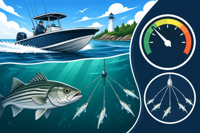
- Trolling: Trolling umbrella rigs, Mojos, or deep-diving lipped plugs along channel edges and over drop-offs is a highly efficient way to find actively feeding stripers. Adjust your depth and speed until you hit the strike zone. If you want to learn more, check out our guide on Trolling Techniques for Long Island Sound Striped Bass.
- Drifting Live Bait: Like with reefs, drifting live bunker or eels along the edges of channels can be very productive. Use just enough weight to keep your bait near the bottom, letting the current do the work.
- Casting into Eddies: Identify where the current hits a bend in the channel or a prominent point, creating an eddy. Cast bucktails or soft plastics into the faster current and let them swing into the calmer water of the eddy where stripers might be waiting.
- Focus on Ambush Points: Stripers will often sit on the "down-current" side of any small bump or irregularity along a channel edge. They'll also patrol the transition zone where the shallow water meets the deeper channel. These are key ambush points.
Advanced Tips for Consistent Success
Becoming a consistently successful striper angler on Long Island Sound means understanding the nuanced factors that influence fish behavior.
Tides and Their Influence on Structure Fishing
Tide is paramount in saltwater fishing, especially when targeting striped bass around structure. It dictates everything from where fish position themselves to when they feed most aggressively.
- Slack Tide Dynamics: During the brief periods of slack tide, when the water movement is minimal, striped bass behavior often changes. Instead of holding tight to current breaks, they might spread out over the structure, actively foraging. This can be a great time for slower presentations, like soft plastics fished subtly on the bottom, or even topwater plugs if conditions are right. However, slack tide can also mean a lull in activity, as the lack of current means baitfish aren't being swept along, and the ambush points lose their effectiveness.
- Strong Incoming and Outgoing Tides: These are often the most productive times. As the current picks up speed, baitfish get disoriented and swept over or around structure, triggering feeding frenzies. Stripers will position themselves on the "down-current" side of a rock, wreck, or ledge, facing into the current, ready to dart out and grab a passing meal. On a strong tide, you’ll need heavier jigs or sinkers to maintain contact with the bottom. Pay close attention to the tide charts for your specific fishing area; knowing exactly when the tide will turn and how strong it will run is invaluable. Many anglers swear by the "last two hours of the incoming and the first two hours of the outgoing" as prime time for Best Time of Day to Catch Striped Bass.
- Understanding Local Tide Charts: Never rely on general tide predictions. Local features, river outflows, and the unique geography of Long Island Sound can cause significant variations in tide times and strength. Apps and local fishing guides often provide hyper-accurate tide information for specific harbors and points. Knowing your local nuances can make all the difference.
Seasonal Movements and Structure Preferences
Striped bass are migratory, and their preferences for certain structures change throughout the year, driven by water temperature and the availability of their primary food sources.
- Spring Migration and Early Season Feeding: As the waters of Long Island Sound warm in spring, striped bass begin their migration into the area. Early in the season, they often key in on shallow, sun-warmed bays and estuaries, targeting smaller baitfish like spearing and river herring. As the season progresses, they'll start moving to more prominent structures like rocky points and channel edges where larger baitfish like bunker begin to appear. They might also be found congregating in areas where there's an abundance of sandworms or bloodworms. For more insights on this period, consider reviewing resources like Connecticut Spring Fishing Day and Opening Day Rules.
- Summer Feeding Patterns: During the heat of summer, stripers in Long Island Sound often seek deeper, cooler waters during the day, relating strongly to deep wrecks, humps, and the deeper edges of channels. They might move into shallower rocky areas or feed on the surface during cooler periods, like dawn, dusk, or nighttime. Offshore reefs and structure that hold large schools of bunker or mackerel become critical. Night fishing for striped bass can be particularly effective during the summer when they become more active in the cooler temperatures.
- Fall Run and Aggressive Feeding: The fall run is legendary for a reason. As water temperatures drop, striped bass become incredibly aggressive, fattening up before their southern migration. They can be found almost anywhere that baitfish are concentrated: over vast schools of bunker, around prominent points, on coastal reefs, and along beaches. During the fall, stripers are less structure-shy and more driven by sheer hunger, often aggressively hitting a variety of lures, from large topwater plugs to flutter jigs. Understanding the Striped Bass Migration Along the Connecticut Coast will greatly assist you in anticipating their movements and pinpointing where they’ll likely be feeding around structure.
By combining your knowledge of these underwater features, marine electronics, visual cues, and the seasonal ebb and flow of striper behavior, you'll be well on your way to mastering the art of reading structure for striped bass in Long Island Sound.
Disclaimer
The information provided in this guide is for general informational purposes only. Fishing regulations, seasons, and licensing requirements in Connecticut can change frequently. Always consult the latest official Connecticut Department of Energy and Environmental Protection (DEEP) fishing guide and regulations before heading out on the water. Ensure you understand all local, state, and federal laws. Fishing inherently carries risks; always prioritize safety and wear appropriate personal flotation devices.